
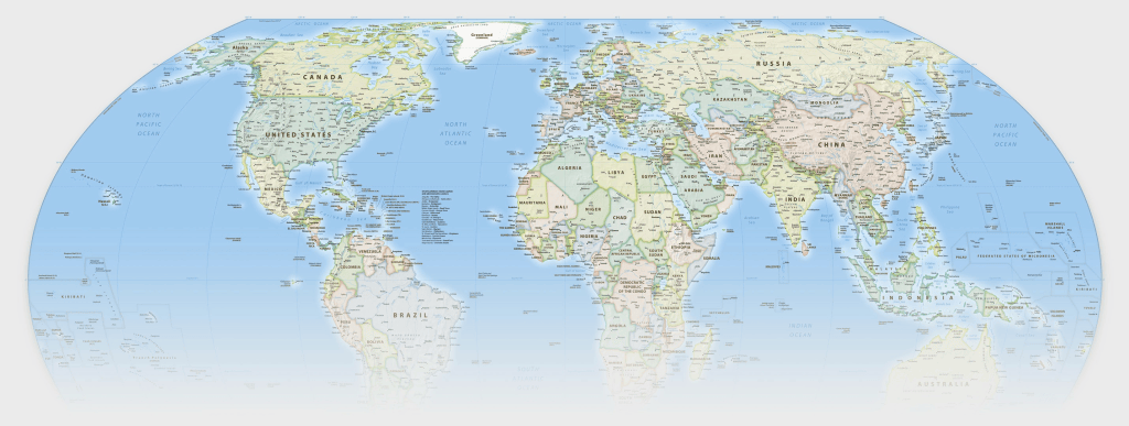
The so-called equal Earth map could be known as the new racist map that distorts northern regions like Alaska and Russia to make them appear small. It is supposed to replace the mercator maps used since the 16th century on 2D surfaces.
Actually space photos of the globe are the sole unbiased ‘maps’ available- like that of global Earth that shows the actual size of continents and nations including Africa, accurately. Eventually e-ink will let even books have interactive globes that don’t distort areas in trying to reduce 3d surfaces to two dimensional replicas- might as well reduce a hypercube to a 3D representation for comparable inaccuracy.
Because wealth is so concentrated with more than half of the population of the world woning less than 2% of the wealth it is understandable that so many nations want poor nations to appear larger as they are, rather than being shrunk in the mercatur maps that were designed for sailors.
The name ‘Equal Earth Map’ is pejorative and political. Equality is a good thing yet when it distorts reality a better name might be sought- perhaps a less inaccurate mildly distorted map with a politically useful name might have worked.


Leave a Reply